Main activities
Main activities
Validation of automatic classification
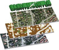
The purpose of this study was to evaluate the appropriateness of using Quickbird 0.6 m – 2.4 m resolution satellite images for the automatic mapping of green structures in urban and suburban areas. A Quickbird image of Oslo, Lørenskog and Oppegård from 2 June 2008 was classified by an automatic algorithm. The algorithm was written in Defininens Developer. The algorithm was trained on a subset of the image, and tested on 6 randomly selected subsets of 1000 x 1000 pixels. The validation was performed by manual editing of the classification result. The main focus of the editing process was to detect misclassifications between grey areas (such as roads and buildings) and green areas (trees, grass, and sparse vegetation). The most striking problem with the automatic method was that the object borders were very rugged. However, these segmentation problems were to some extent ignored in the evaluation process, concentrating on correcting major parts of objects being misclassified rather than correcting all minor segmentation inaccuracies. The result was that the classification step had approximately 9% misclassification rate in the two-class problem grey area versus green area. This is a very good basis for further improvement. The obvious segmentation problems are clearly the first things to address when further improving the method. Another problem is to what extent the automatic method can be used on another image with different light conditions, e.g., with the presence of clouds or light haze. Will a simple retraining of the classification rules be sufficient or will the rules have to be redesigned? It could even happen that redesigning the rules is not sufficient, so that other methods have to be developed.
Literature survey: state of the art of classification methodology
The purpose of this study was to discuss the current state of the art of classification methodology for high-resolution remote sensing imagery in the context of urban green structure, and to suggest possible improvements of the existing classification algorithm, implemented in Definiens Developer. Several methods are presented, with no concern regarding whether they can be implemented in Definiens Developer or not. Experiments are needed in order to get an indication on which of the approaches can be used.
The choice of methods is to a large extent influenced by what remote sensing and other data is available. Clearly, in order to observe changes over time, repeated acquisitions are important, preferably by the same sensor. If different sensors are being used, then, in general, a new automatic classification algorithm has to be developed. At best, an existing algorithm can be retrained on data from the new sensor.


 Hvordan komme til NR
 Del på sosiale media
 Personvernerklæring